
Southwest Arkansas
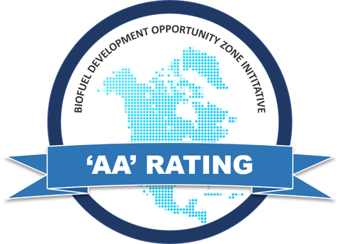
The Southwest Arkansas BDO Zone for Woody Biomass is rated ‘AA’.
Rating Issue Date: August 24, 2026.
‘AA’ ratings denote very high prospective viability of Feedstock Supply and Infrastructure and low expectations of default risk in the Zone. Capacity to support new biobased plant operations is considered very strong.
Southwest, AR, BDO Zone Overview
Feedstock quantities are expressed in bone dry tons per year (bdt/yr), while feedstock costs are expressed in USD ($). Maximum transport distance is based on a 75-mi driving distance from the center point (Prescott, AR).
BDO Zone Assets
- Approximately 1.0 million bdt/yr of very low-risk pulpwood and forest residues is available to a new project; larger quantities are likely available at increased risk.
- Favorable growth-to-drain ratios indicate sustainable harvest levels, leaving substantial fiber available for growth.
- The supply base is broad and geographically diversified.
BDO Zone Liabilities
- A transitioning, aging contractor base will require active investment to rebuild a reliable, modern supply network.
- Competition among existing established consumers will require sustained effort to secure competitive pine pulpwood volumes.
- Undeveloped local chipping infrastructure and limited contractor experience make residue recovery an early-stage challenge.
- Tight driver availability, combined with fuel price and haul distance sensitivity, poses pressure on delivered costs.
Infrastructure
- Location: Interstate 30, Prescott, AR; fronts I-30 between Exits 44 & 46 (~0.5 miles from the interstate; primary access via AR 200)
- Site Size: 126 acres (Industrial zoning; former pastureland, flat topography)
- Availability: Owned by the City of Prescott; $15,000/acre
- Overview: 126-acre industrial-zoned site directly on Interstate 30 in Prescott, adjacent to the area’s largest employer, Holcim. Utilities are on site (water, sewer, electric, fiber), natural gas is adjacent (~200 yards); on-site rail access via Prescott & Northwestern Railroad, which connects to Union Pacific
- Infrastructure:
- Electric: Municipal City of Prescott – three-phase power at 13.8 kV confirmed on site (Contact: Larry Jones, Electric Department, 870-703-8162)
- Natural Gas: Summit Utilities – 2-inch line at 21 psi, adjacent to the site (~200 yards) (Contact: Chauncey Taylor, Summit Utilities, 501-377-4557)
- Water: City of Prescott – 12-inch main on site; sourced from the Little Missouri River, 2 million GPD capacity with 900,000 GPD peak consumption (Contact: Mary Godwin, mgodwin@pnpartnership.org)
- Wastewater: City of Prescott – 8-inch main on site; WWTP capacity of 850,000 GPD with 600,000 GPD peak treatment (Contact: Mary Godwin, mgodwin@pnpartnership.org)
- Fiber: Brightspeed – fiber optic connections on site (Contact: Bobby Holt, Brightspeed, 870-809-9905)
- Transportation Access:
- I-30 (~0.5 miles); AR 200 (Ron Harrod Blvd) frontage
- On-site rail via Prescott & Northwestern Railroad, connecting to Union Pacific Railroad; Arkansas Midland Railroad (Genesee & Wyoming) ~1 mile
- Kizer Field Airport (~2.5 miles); Gurdon Lowe Field (~15.4 miles); Texarkana Regional-Webb Field (~41.8 miles); Little Rock National (~92.6 miles)
- Site Contact: Mary Godwin, Director, Prescott Economic Development | (870) 703-4912 | mgodwin@pnpartnership.org
- Location: I-30, Texarkana, AR; frontage on both I-30 & US-67; ~8.5 miles of I-49 & ~8 miles of US-82
- Site Size: 1,350 acres (Industrial zoning)
- Availability: $7,500/acre
- Overview: 1,350-acre manufacturing complex, built around the region’s century-old rail infrastructure. Fronting I-30 & US-67, offers close connectivity to I-49, I-369, and US-59, US-71, and US-82. Within 300 miles of Dallas, Fort Worth, Houston, Oklahoma City, Little Rock, Memphis, Shreveport, and Baton Rouge.
- Infrastructure:
- Electric: Southwest Arkansas Cooperative
- Natural Gas: Kinder Morgan
- Water: Texarkana Water Utilities – on site
- Wastewater: Texarkana Water Utilities – on site
- Fiber: Four States Fiber
- Transportation Access:
- I-30 (0 miles); US-67 (0 miles); I-49 (~8.5 miles)
- Union Pacific Rail on site; Kiamichi Railroad (~6.7 miles); Kelowna Pacific Railway (~6.3 miles)
- Hope Municipal (~15.8 miles); Texarkana Regional-Webb Field (~9 miles); Shreveport Regional (~75.4 miles)
- Site Contact: Rob Sitterley, AR-TX REDI | (903) 824-1792 | rob.sitterley@ar-txredi.com
- Location: Hwy 32, Hope, AR; >3 miles from US-278, AR-4, AR-29, and I-30; ~28 miles from I-49.
- Site Size: 78 acres (Industrial zoning); subdividable, minimum 20 acres, up to 68 additional acres.
- Availability: Owned by the City of Hope and Hope Water & Light; $10,000/acre
- Overview: A 78-acre industrial site in Hope, part of a broader industrial park designation, in an area with existing facilities from Tyson Foods, New Millennium Building Systems, Klipsch and Associates, Georgia-Pacific, Hexion Chemicals, Old Castle, Funder America, and Amerities West.
- Infrastructure:
- Electric: Hope Water and Light
- Natural Gas: Summit Utilities
- Water: Hope Water and Light
- Wastewater: City of Hope
- Fiber: Southwest Arkansas Telephone Co-op and Hope Water and Light
- Transportation:
- I-30 (~2.9 miles); US-278 (~1 mile); AR-29 (~1.9 miles)
- Union Pacific Railroad ~0.6 miles (has rail spur); Kiamichi Railroad (~3.4 miles); Kelowna Pacific (~2.9 miles)
- Hope Municipal Airport on site (0-1.2 miles); Texarkana Regional (~28 miles); Kizer Field (4F7) ~16.5 miles
- Site Contact: Anna Powell, President, Hempstead County Economic Development | (870) 777-8485 | anna@hopeusa.com
- Location: 3211 Highway 67 S, Arkadelphia, AR; on US-67 (~1-1.5 miles from I-30)
- Site Size: 991 acres (Industrial zoning; former farmland); subdividable, minimum 20 acres
- Availability: Publicly owned; $25,000/acre
- Overview: A 991-acre publicly owned industrial property in Clark County, positioned less than 1.5 miles from I-30 with direct access to US-67; ~0.5 miles from Union Pacific Railroad. Site is both Entergy Arkansas Select Site certified and Electric Cooperatives of Arkansas ONSite certified, reflecting extensive infrastructure, utility, and environmental review. Electric, water, sewer, and fiber are all available on site.
- Infrastructure:
- Electric: Entergy and South-Central Arkansas Electric Cooperative
- Natural Gas: Summit Utilities
- Water: City of Arkadelphia (Arkadelphia Water Utilities) via a 16-inch main; on site
- Wastewater: City of Arkadelphia (Arkadelphia Water Utilities), 8-inch main; on site
- Fiber: South Central Connect or AT&T
- Transportation:
- I-30 (~1-1.5 miles); State Hwy 26 & US-67 (0 miles)
- Union Pacific Railroad (~0.5 miles); Prescott & Northwestern Railroad (~22 miles)
- Dexter B. Florence Memorial Field (~3.3 miles); Gurdon Lowe Field (~8.1 miles); Clinton National Airport (~75 miles)
- Site Contact: Shelley Short, President & CEO, Arkadelphia Alliance | (501) 944-2028 | shelley@arkadelphiaalliance.com
Local Grants and Incentives
Advantage ArkansasIncome tax credit of 1–4% of new payroll; 5-year accrual with a 9-year carry forward.
Create RebateCash payment of 3.9–5% of new payroll; 1–10 year accrual.
Tax Back ProgramSales and use tax refund — a full refund less 1% on eligible expenditures; 4-year accrual.
ArkPlusIncome or sales & use tax credit of up to 10% of initial investment; 9-year carry forward.
Modernization & Automation Tax CreditsIncome or sales & use tax credit of up to 5% of eligible project costs, with a minimum of $25 million eligible investment.
Infrastructure AssistanceState and federal funds to offset infrastructure costs, based on need and due diligence.
Customized Training ProgramReimbursement of eligible costs for on- and off-site training, customized based on need.
Property Tax AbatementAuthorized and offered by city or county; up to 65% abatement, with the length of abatement equal to the length of bond issuance.